
Finding Patterson Addresses Street by Street
A Patterson street directory is most reliable when it is built as an evidence chain. Begin with the complete address, including a directional or route variant. The free Stanislaus County GIS Hub can locate an address, APN, road intersection, or map point. The parcel becomes the cross-system key. From there, the Assessor can supply property facts, RecorderWorks can supply recorded parties, and city files can add a dated applicant or project record.
- Verify the street spelling, city, ZIP, and any route alias. Save the original form of the address.
- Search the GIS map, zoom until parcel lines appear, and click the lot to copy its APN and legal subdivision details.
- Run the APN through Assessor Public Inquiry, then use the Modesto self-service station when broader public-roll fields are needed.
- Use the assessed owner and current document reference in RecorderWorks. Search the deed party by name and date, not by an assumed occupant.
- Request a dated permit, planning, code, or city record when the question concerns a project, then use historical directories only for years actually held.
This route answers who owns, what parcel is involved, what was recorded, and what public event occurred at an address. It does not turn a street into a current household roster.
Turn a Patterson Street Address Into an APN
GIS is the cleanest first move because the Assessor’s unrestricted web product expects a parcel number. In the Parcel Inquiry Map, search by address or point, select the parcel, and note the APN. The map can also expose nearby parcel geometry, zoning, general-plan information, districts, flood layers, and aerial context. Recorded-map tools use address, APN, or road intersection; after zooming, the user can turn on subdivision, parcel-map, or record-of-survey layers and open a linked PDF when one is digitized.
Keep the APN with the legal description. The street label is a human-friendly clue, while the legal description identifies land through a subdivision, lot, block, map, or survey reference. That distinction matters in the older center of Patterson, where the radial plan around Circle Plaza and the dual name of Highway 33 and Second Street can make a literal address search miss a useful record.
The county’s recorded-map guide is available through the Stanislaus Public Works map instructions. It describes categories such as parcel maps, subdivision maps, records of survey, corner records, certificates of correction, and tie cards. A map is not a resident list, but it can explain why two records use different lot or street language.
Patterson Street Records by Address
The address-keyed sources in Patterson each carry a different kind of evidence. The table shows the chain without treating any one record as a full street directory.
| Record set | Keeper | What it can show | Access |
|---|---|---|---|
| Parcel geometry and GIS | Stanislaus County GIS | APN, boundaries, nearby parcels, zoning, districts, flood and aerial context | Free map hub |
| Assessment roll | County Assessor | Assessed owner, situs, mailing, values, exemptions, characteristics, document reference | APN web basics, kiosk, restricted remote channel |
| Recorded instruments | Clerk-Recorder | Grantor, grantee, document type, date, identifier, deed image or copy | Free index, paid copy |
| Property tax | Treasurer-Tax Collector | Tax bill and payment information tied to an APN | APN search |
| Permits and planning | Patterson Community Development | Applicant, agent, address, APN, work and inspection chronology | Counter or CPRA request |
| Historic address sources | Library and Historical Society | Occupant printed at a specific directory or yearbook date | Collection-specific, often in person |
The APN links the map, assessment, tax, deed, and planning trails. The street name helps a human search, but it does not replace the parcel key. A recorded owner, permit applicant, or old directory occupant should be described by date and source.
Read a Patterson Parcel Field by Field
Assessor data has more detail than a simple owner label. The county schema documents the fields below, although the free APN view does not promise every field. The Modesto self-service stations are the public route for fuller inspection.
| Field | Meaning in a street search |
|---|---|
| Assessee or owner | The person or entity attached to the assessment, not every household member. |
| Situs | The physical property address in Patterson or the surrounding county. |
| Mailing | The notice destination, which can differ from situs. |
| Current document | A date and number that can lead into RecorderWorks. |
| Transfer history | Transferor, transferee, event date, price or type when held in the channel. |
| Characteristics | Land use, units, year built, size, structure, exemption, and related assessment fields. |
The Assessor database definitions are useful when a field looks like a conclusion. A homeowners exemption does not enumerate the household. A mailing match does not prove that the owner sleeps at the parcel. Treat each value as a clue with a defined scope.
Browse Patterson Parcels in GIS
To walk a street, use the GIS map instead of expecting a ZIP-wide or resident-name filter. Search the subject address or APN, zoom until lot lines are visible, and pan along the block. Click each parcel and record its APN. The map’s layer list can add parcels, zoning, general plan, districts, flood information, and aerial imagery. A recorded-map layer may open a map name, volume and page, city, and PDF link.
Manual adjacent selection is the supported method documented for the current app. No verified radius or buffer tool was captured. That matters for a neighbor question: the map can show which polygons touch, but it cannot decide which people share a home, use a back gate, or identify an unlisted resident. Pass each APN to the Assessor and then keep parcel facts apart from household assumptions.
Patterson’s 1909 Colony map created a town centered on Circle Plaza with streets radiating outward. That history is more than local color. It explains why the map, a route name, and a modern grid view can describe the same place in different ways. The Patterson downtown plan map helps place the post office, library, museum, and radial street pattern.
Patterson Permits Date Work, Not Residence
A city permit or code file can be a valuable address record. An application may name an owner, applicant, architect, or agent. Plans can date an addition, while inspection cards create a sequence of work. Those facts show a connection to a project at a stated time. They do not establish continuous residence or every person who used the building.
Patterson’s request-routing page asks what help is needed, whether the requester wishes to remain anonymous, how follow-up should occur, and the location or cross street when the issue is tied to a place. The actual CPRA-specific form appears after the category is selected. The Patterson NextRequest portal offers a search of published requests and a new-request workflow.
Review the form fields before sending a request through the City request page.
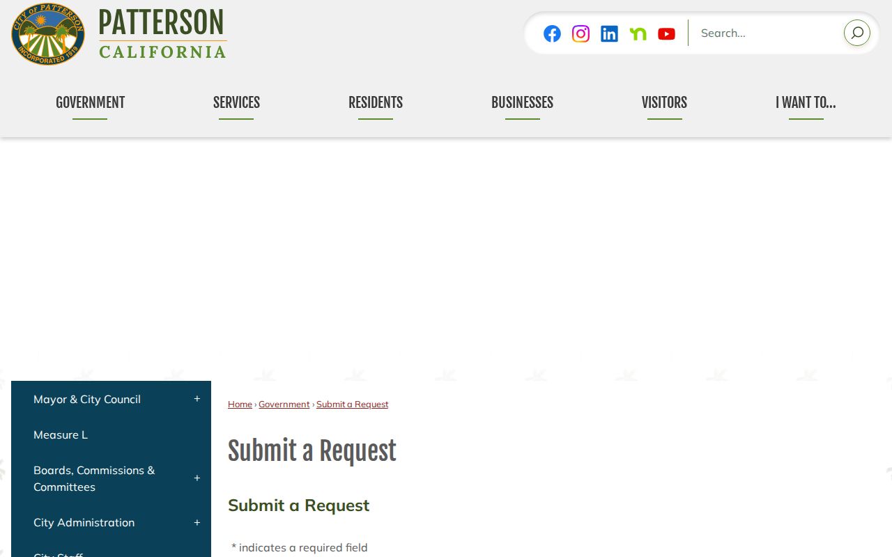
The routing screen is a reminder to ask for a narrow address, APN, project type, or date range. Narrow wording helps the City identify the right custodian and avoids implying that a complete online permit archive exists.
Book and Page Before 1980
Patterson deed research has a local identifier split. RecorderWorks uses book and page for pre-1980 instruments and annual document numbers for instruments from 1980 forward. Recorded maps retain book and page. A searcher who copies only a modern number into an older map or deed path can lose the link between the parcel and its prior records.
When the current Assessor document points to a newer instrument, open that deed and write down the grantor, grantee, date, legal description, and identifier. Search the seller as an earlier grantee. If the web index returns no image, use the Clerk-Recorder office, the official copy-request form, or the book and page fields. The official-record form asks for document title, record date, document number, volume, page, page count, copies, and certification choice.
The online index reaches from 1850 to the present, but early indexing and image availability vary. The barrier is not a modern cutoff. It is the quality and completeness of the material behind the search result.
Situs, Mailing, Plat, and Parcel
Four terms prevent a Patterson street directory from making a false leap.
- Parcel
- A mapped piece of land with an APN. A parcel is not a household.
- Situs address
- The physical location of the land or structure.
- Mailing address
- The destination for assessment notices. It may be elsewhere.
- Plat
- A recorded map showing a subdivision, lot, block, or related land layout.
- Criss-cross directory
- A historical address or street arrangement, if a local volume contains it, that can supplement a surname search for one year.
The legal description can outlast a street alias. Preserve it beside the APN and the street spelling used in the source. That makes later deed, map, and historical-directory searches far more precise.
Reverse Directories in Patterson
Library and Historical Society collections may contain a street-order or criss-cross section, but the research record does not verify an exact Patterson reverse-directory run. The Stanislaus County Library’s Special Collections holds noncirculating city and telephone directories, with systemwide holdings dating to at least 1914. Ask reference staff to confirm the year, publisher, street section, and abbreviation key before relying on it.
A historical street entry can show a name at a printed address, sometimes with an occupation or household notation. It does not prove that every member of the household lived there, and a missing name can mean a move, death, omission, or a year that was not published. The Patterson city directory collections page handles those historical questions in full.
What a Patterson Street Directory Cannot Show
A street directory cannot reveal all occupants or other household members, utility customers, DMV address details, protected voters, or private association membership. A deed names parties to an instrument. An Assessor record describes the assessment. A voter file is controlled by California Elections Code and is not an open street roll. A reverse directory is a dated printed clue. Each has a boundary.
Lawful use. Patterson address records are appropriate for family history, estate work, civic research, reconnecting, and personal safety awareness. Do not use street or parcel information to stalk, harass, intimidate, or harm anyone.
California Penal Code section 646.9 and Code of Civil Procedure section 527.6 describe serious limits around stalking and civil harassment. If a record is wrong, contact the Assessor, Recorder, City, Elections office, or other original custodian. A corrected source record is stronger than a copied claim.