
Patterson ZIP Codes and What 95363 Covers
Research verified one ordinary mailing ZIP for Patterson. USPS uses 95363 for incorporated Patterson and surrounding rural or unincorporated territory, including the Grayson corridor. That makes the ZIP useful for mail and address validation, but too broad to stand in for the City of Patterson boundary.
| ZIP code | Areas covered | Post office | Notes |
|---|---|---|---|
| 95363 | Incorporated Patterson plus surrounding rural and unincorporated territory, including Grayson | Patterson Post Office, 50 N. Salado Avenue; Grayson Village Post Office at One Stop Market | Only verified ordinary Patterson mailing ZIP; crosses the city line |
Nearby Westley uses 95387 and Crows Landing uses 95313. Those are separate postal names and delivery areas, not additional Patterson postal areas. The USPS national ZIP resources provide the postal lookup starting point. Do not fill the table with unverified ZIP splits, unique ZIPs, or historical realignments. None was verified in the research.
95363 Is Patterson’s Verified Mailing ZIP
The Patterson Post Office listing gives 50 N. Salado Avenue, Patterson, CA 95363-9998, with phone (209) 892-8852. Retail hours are weekdays 8:30 to 5. PO-box access is weekdays 6 to 6 and Saturday 6 to 5, with box delivery Monday through Saturday at 11. Carrier and general delivery, PO Box Online, and bulk services are listed, while passport service is not.
Those details make USPS the first stop when a record contains an incomplete address or a questionable postal city. Verify the street, city, state, and ZIP before sending a county request. A valid ZIP does not settle whether the address lies inside Patterson, in an unincorporated area, or under a different city service boundary.
The official USPS ZIP Code Lookup can check an address or city and state. It is a postal verification tool, not a resident search, so carry the verified address into the parcel map rather than stopping at the ZIP result.
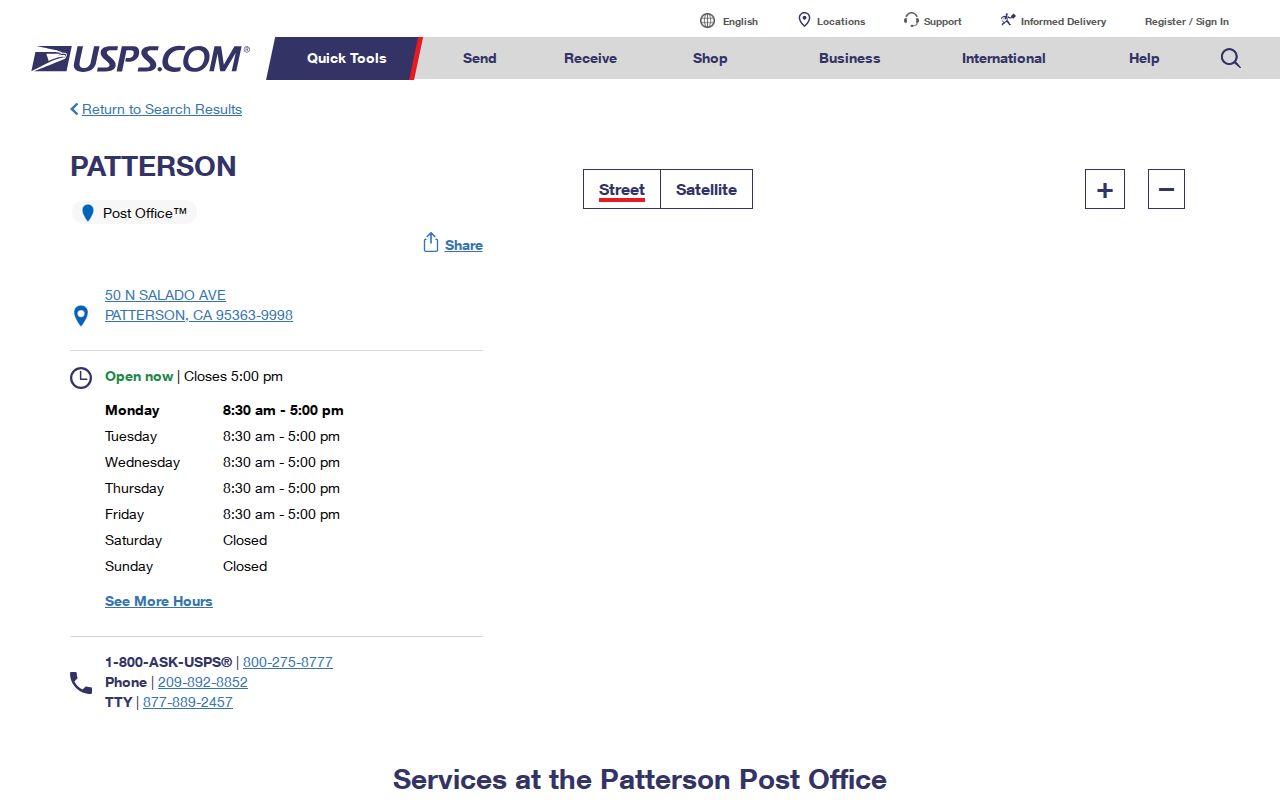
The facility result confirms 95363 for the Patterson post office while leaving jurisdiction and household questions to the proper local records custodian.
Grayson Uses Patterson 95363
A distinctive postal quirk sits just outside the city. USPS gave the Grayson Village Post Office a “Patterson CA 95363-9495” address. A person may therefore write Patterson as the mailing city even when the property is not inside incorporated Patterson. That is why a Patterson mailing label cannot prove City of Patterson jurisdiction.
For this postal search, mark the mailing clue and the legal-place clue separately. The county GIS map can show the parcel, city limits, annexation, district, and general-plan context. Patterson Planning administers annexation and map questions through (209) 895-8020. A city record request may also need the parcel or project address rather than the postal city alone.
When a name is tied to 95363, use the ZIP as a narrowing field only. Confirm the APN, situs, and custodian before describing the person or property as part of Patterson.
Search Patterson Residents by ZIP
A postal-boundary search should move from postal verification to local jurisdiction. The county does not provide a verified ZIP-wide resident portal in the research. The Assessor’s free web route is APN-keyed, and the voter file is restricted to approved purposes. Use 95363 to check the address and narrow a name, not to produce a list of Patterson households.
- Run the complete street address through the USPS lookup and save the standardized city, state, and ZIP.
- Open the Stanislaus County GIS Hub, locate the parcel, and copy the APN and legal description.
- Use the APN in Assessor Public Inquiry or inspect fuller public-roll fields at the Modesto self-service station.
- Use RecorderWorks, city requests, or a historical collection for the particular name or date question.
- Once the ZIP narrows to a street, use the Patterson street directory for the address-keyed chain.
This sequence prevents a postal label from doing the work of a parcel map. It also avoids claiming that a missing ZIP filter means a missing record.
The official USPS address and city ZIP verification form is the visual check to make before the county handoff.
That check standardizes the mailing clue, while GIS and the Assessor decide which parcel and jurisdiction the address belongs to.
From ZIP Address to Patterson APN
The APN is the best cross-system key after the ZIP has been verified. GIS can search by address, APN, or point and show parcel lines, nearby geometry, zoning, general plan, districts, flood layers, and aerial context. The Tax Collector’s online route also requires an APN. The Assessor’s public web view returns basic assessment and characteristic data for a known parcel.
Keep three place fields in your notes: postal city and ZIP, situs address, and owner mailing address. They may all differ. A postal city can cross the city line. A situs is the physical parcel. A mailing address can be a different residence, business, manager, or post-office box. None of those fields is a complete resident list.
For recorded maps, the county documents search by address, APN, or road intersection and map layers for subdivisions, parcel maps, and records of survey. A map PDF can clarify lot and block identity when a street name or ZIP search does not line up.
Postal City, Legal City, and ZCTA
Postal geography, legal geography, and Census geography are different systems. USPS routes mail. The incorporated Patterson boundary controls city jurisdiction. A ZCTA is a Census statistical approximation of a ZIP area, not an exact delivery boundary. This guide should label which system each fact comes from.
- ZIP code
- A USPS delivery-area code used with a mailing address.
- ZIP+4
- The extended postal code that narrows delivery beyond the five-digit area.
- PO-box route
- A postal service point whose address may not describe the legal location of a home or parcel.
- Carrier route
- A delivery route inside a postal operation, not a city boundary or resident category.
- ZCTA
- A Census approximation used for statistics. It should not replace USPS or a city-limit map.
These definitions matter when a ZIP is used to compare names or records. A statistical table may cover more or less land than a USPS delivery area, while a legal city map may cut through the same postal ZIP.
Circle Plaza Breaks Grid Assumptions
Thomas W. Patterson’s Colony map was filed on December 13, 1909, with a plan modeled after Washington and Paris. Circle Plaza sits at the center, with streets radiating outward. Highway 33 is also Second Street. That local geometry can make an old address look different from a modern street search even when the parcel is the same.
Try the route name, street name, directional prefix, APN, legal lot or block, and recorded map reference. Do not invent a renumbering year; the research did not verify one. The Patterson downtown plan map is useful visual context for the radial center, post office, library, and museum.
The address quirk belongs in this guide because postal validation alone cannot resolve older land references. Geography must be checked against the parcel and the legal description.
Known Patterson ZIP Data Gaps
Research did not verify a ZIP split or realignment history for Patterson, a PO-box-only or unique ZIP, a ZIP-filterable Assessor portal, a ZIP-filterable voter portal, or a ZIP-wide local resident database. Those absences should be stated plainly. A ZIP code directory is more trustworthy when it distinguishes verified 95363 facts from fields that still need an office answer.
For a missing jurisdiction detail, contact Patterson Planning or use the county GIS map. For a missing property detail, use the APN and the Assessor. For a missing recorded instrument, use RecorderWorks or the Clerk-Recorder copy form. For a city administrative record, send a narrow request through Patterson’s request route under the California Public Records Act.
A gap is not a reason to substitute a commercial compilation. It is a prompt to identify the custodian, the record type, and the smallest useful request.
Patterson ZIP Geography Versus City Limits
The 95363 ZIP crosses the incorporated Patterson line and includes the Grayson corridor. Nearby Westley 95387 and Crows Landing 95313 are separate postal areas. A Patterson postal city therefore cannot prove that the parcel is within city government, and a nearby postal name cannot alone exclude a Patterson connection.
Boundary check. Verify the address with USPS, the parcel with Stanislaus County GIS, and the jurisdiction with the city or county map before relying on a ZIP-based conclusion.
For a name search, the ZIP can help distinguish similar records, especially in the State Controller unclaimed-property tool, which accepts city and ZIP fields. It remains a reported-name clue, not present-residence proof. Once the boundary is clear, use the record keeper that owns the fact.
The Assessor access page and the county GIS hub supply the next local step after postal verification.